

The Emma Carlin trails are a shared hiking/biking trail system just outside of Palmyra, Wisconsin. There are three trails (descriptions provided by the DNR website*):
Brown Loop, moderate, 3.5 miles: Skirt in and out of pines and hardwoods, pass a kettle lowland, then after joining up with the orange loop, proceed uphill along a moraine and back downhill to the trail head.
Orange Loop, moderate/hard, 6 miles: Traverse the contours of the glacial geography, generally uphill to the scenic overlook where the Connector trail meets the Carlin trails. Then get ready for lots of ups and downs until meeting back with the brown loop.
Green Loop, hard, 8 miles: This trail is continuous with the orange, until it splits off on the southern half of the loop. Here you are in for several difficult ups and downs.
*The trail distances are slightly different on the map at the trailhead. Between those discrepancies and GPS inaccuracy on the switchbacks, it is best to assume that each of these distances is an estimate.
A PDF of the trail map is available here.
Emma Carlin at a Glance:
Parking: Excellent. Large Lot.
Restrooms: Yes. Pit Toilets.
Terrain: Single track trail. Can be rugged at times. Roots, rocks, sharp turns, some switchbacks.
Location Perks: The Ice Age Trail can be picked up from the Emma Carlin parking lot (Blue Spring Lake Segment) or from across the road (Stoney Ridge Segment).
Pay Area: Yes. Wisconsin State Park pass required.
Restrictions: Yes. Trails are shared with mountain bikes.
Hunting allowed: Hunting is allowed in the nearby state forest.
Getting There:
The headquarters for the Southern Unit of Kettle Moraine State Forest lies midway between Eagle and Palmyra on Hwy. 59. Trail maps are available at the headquarters. Trailhead parking is located off County Z.
The trailhead is roughly a 50 minute drive from Milwaukee, or just over an hour from Madison.
Coordinates: 42.87035336358371,-88.543839505688013
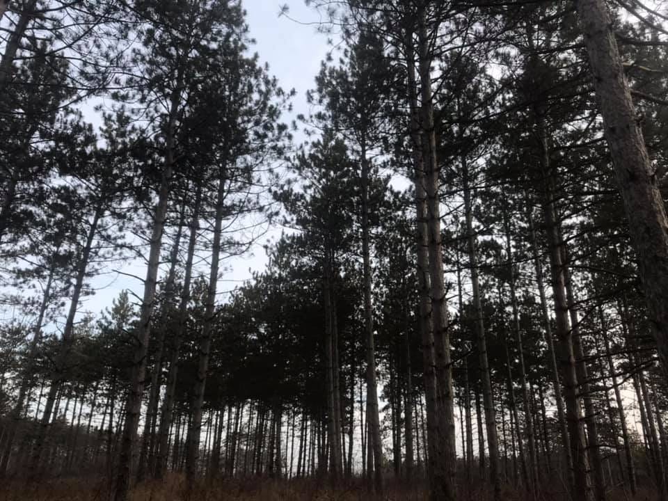
The Terrain:
The Emma Carlin trails are not for the timid. The green loop, while the longest, seems to be the preferred loop among runners as it offers some of the best views. The brown loop is nice and short but because of how it intersects with the other trails it can be confusing to navigate. No matter which trail you choose you will be treated to plenty of short climbs, steep descents and some switchbacks.
Fall is particularly challenging at Emma Carlin. The fallen oak leaves blanket the trail and disguise the rocks and roots.
Even seasoned trail runners might be surprised to feel a noticeable difference in their pace on these trails as compared to wider trails or the roads. The uneven terrain demands caution, and caution often means a more moderate pace. Don't expect to run your fastest miles here.
Sharing the Trail:
The Emma Carlin trails, like the nearby John Muir trails, are open to mountain bikers, so a little knowledge about trail sharing etiquette is helpful. Foot traffic (hikers/runners) should run the trails clockwise, will bikers will ride the trails counterclockwise. (If you forget, the trails have a marked "hiker entrance" and "biker entrance" at the trailhead).
Yielding. As the trails here are single track, whenever a runner or hiker and a biker are on the same trail, one will have to yield to the other. Trail etiquette rules say that fast yields to slow, so a bike should yield to a runner, and a runner should yield to a hiker. But let's be real: these are tough trails and if it looks like the biker may not be able to yield in time for you, exercise caution and vocalize your intention. Being safe, aware, and courteous goes a long way.
Good trail stewardship: as trail runners, we want to leave a very light footprint on any of the trails that we run. When there are heavy rains or lots of snow melt that leaves the trails muddy, the best practice is to avoid the trails. Shoe prints in squishy mud become deep ruts that freeze in the winter and become ankle-twisters for runners and hikers and equally awful for the mountain bikers.
Trail Navigation:
The Emma Carlin trails are not the easiest to navigate. There are sections where the trail crosses itself, creating intersections that are not necessarily well-marked. A good rule of thumb is to progress forward at these intersections, as opposed to turning to the left or right. However, there are times where "forward" is not necessarily obvious. You can also rule out trails that are marked with an "Emergency Route" sign on them. Finally, know that if you are facing a metal map of the trails (with the exception of the map at the trailhead), you are facing North. But if you aren't positively confident in your trail navigation skills, be sure you have a trail app like All Trails handy on your phone to assist you.
So, who was Emma Carlin?
Great question. I love learning all about the history of the trails we run on, but there's not a lot of information out there about the trail's namesake. A post on a message board suggests that she was a schoolteacher in Lake Mills and Palmyra who donated the land that the trails lie on. I'd love more information if anyone has any leads.
Hoot Rating
A trail's Hoot Rating is my totally subjective opinion of the joy of running on a particular trail. Again, this is a subjective rating - my least favorite trail might be someone else's crown jewel, so take this rating with a grain of salt. But whatever the rating, I will always try to explain my reason for it.
Here's the scale:
One Hoot - This trail did not spark joy. It probably sparked a little misery. Not recommended for trail running unless you are an absolute completest, and even then you might think twice.
Two Hoots - A Two Hoot trail isn't awful, and if you are a completest you'll be happy you ran it. But you won't be calling up your friends or making plans to go back anytime soon.
Three Hoots - A solid trail. Nothing terribly remarkable, yet nothing awful. It is the plain yogurt of the trail world - adequate, but you probably wouldn't make it your first choice.
Four Hoots - This is a great trail. If your friends invite you to this trail, you wouldn't hesitate to join them. It may not be perfect, but it is a lot of fun.
Five Hoots - What a fantastic trail! When you want to "wow" an out-of-state friend with a great Wisconsin trail, this one will come to mind easily. It would be hard to imagine a way to improve on this trail. A Five Hoot rating is reserved for only the best trails.
Emma Carlin's Hoot Rating:
Three Hoots. The trail has a lot of redeeming qualities, most notably its great parking, proximity to other trails, and terrain variety. The trail markings at intersections aren't great, making it a little challenging at times, and sharing the trails with mountain bikes is always a challenge. Running Emma Carlin in fall is especially tough due to the leaf litter covering the neverending rocks and roots. You can certainly have a good time at Emma Carlin and get in a good workout, but it wouldn't be my first choice.
A very fair rating. If I were a mountain biker, I would probably give it 5 hoots. Hiking, not so much, partially due to sharing it with Mountain bikers. I have never had any issues crossing paths with them; in fact the biker is supposed to yield to hikers, but it seems so much easier for me to step off rather than make a biker slow down, un-clip, pass and reverse-repeat. Every time, they are appreciative of the gesture. Good trail to do once, and say that's done.